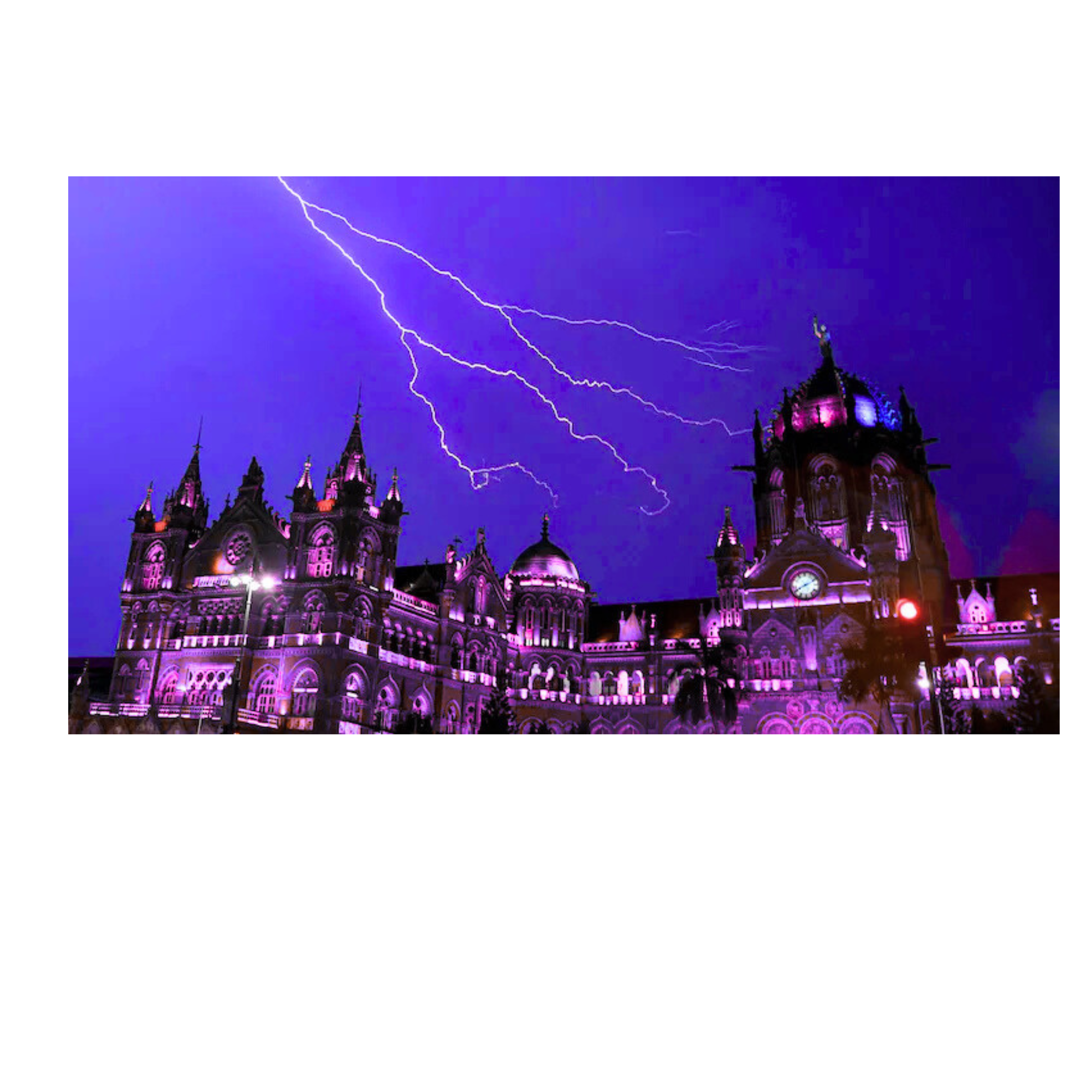
The India Meteorological Department (IMD) has announced an orange alert for Mumbai on May 23 and 24, indicating the possibility of heavy to very heavy rainfall, along with thunderstorms and strong winds that may reach speeds of 50 to 60 kilometers per hour in certain areas.
The Indian Meteorological Department (IMD) has announced a “red alert” for multiple coastal districts in Maharashtra and Goa, indicating the expectation of very heavy to extremely heavy rainfall from Friday through the weekend. As per the weather office, a red alert has been issued for Goa, Raigad, and Ratnagiri on May 23, predicting the possibility of extremely heavy rainfall. Additionally, an orange alert is active for Mumbai, Thane, Palghar, Sindhudurg, as well as the ghats of Pune and Satara during this timeframe, signaling heavy to substantial rainfall along with thunderstorms and strong winds, according to PTI. The IMD has also issued an orange alert for Mumbai for May 23 and 24, cautioning about heavy to very heavy rainfall, which may be accompanied by thunderstorms and gusty winds reaching speeds of 50 to 60 kilometers per hour in isolated areas.

As per the meteorological department, the reason for the pre-monsoon rainfall is attributed to the development of a low-pressure system situated over the east-central Arabian Sea, adjacent to the southern coasts of Konkan and Goa. The India Meteorological Department (IMD) indicated that this system is expected to strengthen and deliver heavy rainfall across Konkan and various regions of Maharashtra. On Thursday, Shubhangi Bhute, an official from the Regional Meteorological Centre, stated that the low-pressure area is anticipated to further intensify within the next 36 hours and shift northward. “Consequently, the entire Konkan coastline has been placed under an orange alert, while a red alert has been issued for the districts of Raigad and Ratnagiri. During this timeframe, wind speeds are expected to vary between 30-40 km/h, with isolated areas potentially experiencing gusts up to 60 km/h,” Ms. Bhute remarked. Certain locations are expected to experience heavy to extremely heavy rainfall accompanied by thunderstorms, she cautioned, advising fishermen to refrain from going out to sea along the coasts of Gujarat and Maharashtra. “The sea conditions are predicted to be rough until the night of May 23… and are likely to escalate to rough to very rough from May 24 to 27,” the IMD bulletin noted, further stating that “conditions are expected to become favorable for the onset of the Monsoon over Kerala in the next 2-3 days.”
Also Read | Pakistan Denied IndiGo Pilot’s Request to Utilize Its Airspace to Evade Turbulence: Report Fishermen who are currently at sea have been instructed to return to shore by the afternoon of May 23. Fishing activities in the Eastcentral and adjacent Northeast Arabian Sea will be halted from May 25 to 27, according to the weather office. In addition, an isolated hailstorm is forecasted for Himachal Pradesh, along with isolated heavy rainfall in Uttarakhand on the 23rd and 24th of May. A duststorm, with speeds reaching 40 to 50 kilometers per hour, is also anticipated over West Rajasthan from May 23 to 25. Heatwave Diminishment As per the India Meteorological Department (IMD), heat wave to severe heat wave conditions are predicted in isolated areas of West Rajasthan from May 22 to 24. Heat wave conditions are also highly probable in isolated regions of Jammu, Punjab, Haryana, Chandigarh, and northern Madhya Pradesh on May 23. Both East Rajasthan and West Rajasthan are expected to face a heat wave in the upcoming days. “Warm night conditions are very likely in several areas of southern Haryana and Punjab on the 22nd and 23rd, as well as in West Rajasthan from the 22nd to the 24th of May,” stated the weather office.